Developing Smarter Tools for Maximizing the Value of Irrigation

Developing Smarter Tools for Maximizing the Value of Irrigation
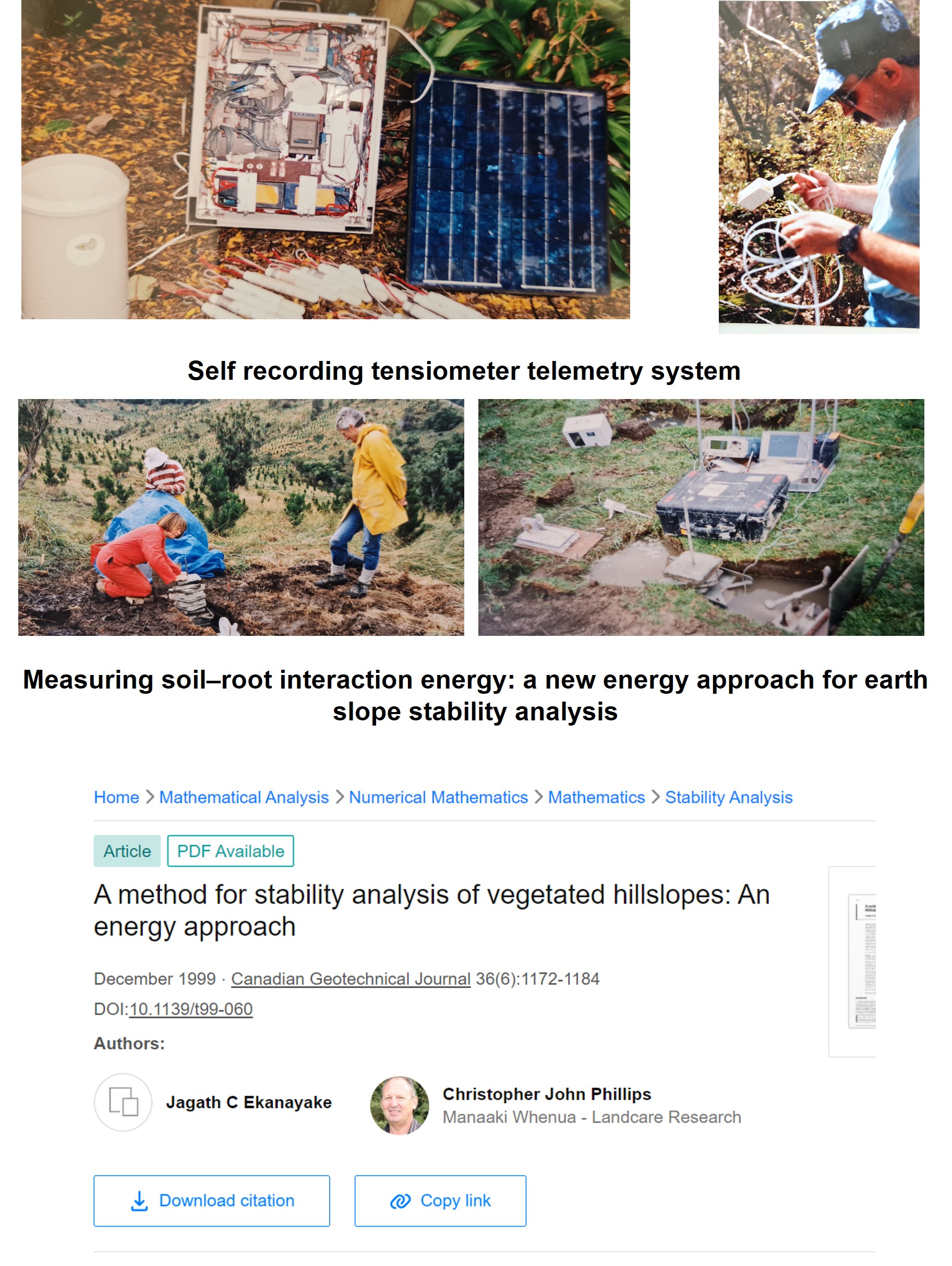
Self-recording tensiometers:
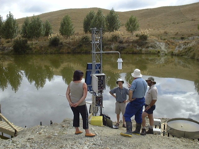
Tensiometers are used to measure soil water pressure in the soil. Soil water pressure helps one to understand water flow patterns in soil. Because tensiometers were manually read, regular field visits were essential to collect data from remote sites in early 1990. We configured Campbell Scientific data loggers and modems to send tensiometer and other sensors readings to Manaaki Whenua office over the cellular network. This system was used to monitor and study effect of climatic induced pore-water pressure on earth flows dynamics in Mangatu forest, Gisborne in 1990 (program leader Chris Phillips). Shear testing machine was designed to measure energy contribution from soil-root interaction to be used in slope stability analysis.
Wireless sensor networks:
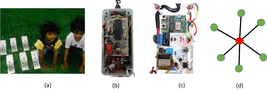
In 1990's sensors were hardwired to central dataloggers which run on solar backed rechargeable batteries restricting the spatial measurements of environmental variables. We developed wireless sensor networks on star topology using remote garage door openers to enable spatial measurements of environmental variables. The sensor networks were successfully tested by Oregon state University postgraduates in St. Andrews Forest. However low range remote garage door openers limited the measurement area to < 0.5 Sq.Km.
Mesh networking:
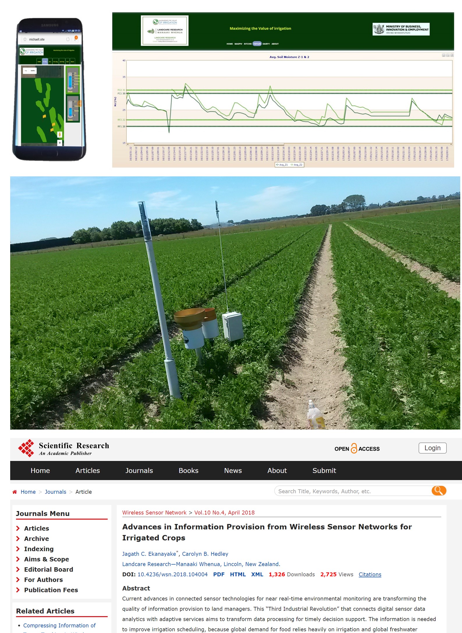
Short range Wireless Mesh Networks using Digimesh radios were developed to gather spatial distribution of soil moisture in farms and visualize data over web enabled devises in near real time. Mesh networking allows one to expand the measuring area to cover large farms, provided one sensor node has direct line of sites with two more sensors. In Mesh Networks, data hop from one sensor to another until they reach the gateway which could be many km away from the measuring point. Wireless moisture sensor networks have been a major part of the successful "Maximising the Value of Irrigation" program led by Dr. Carolyn Hedley.
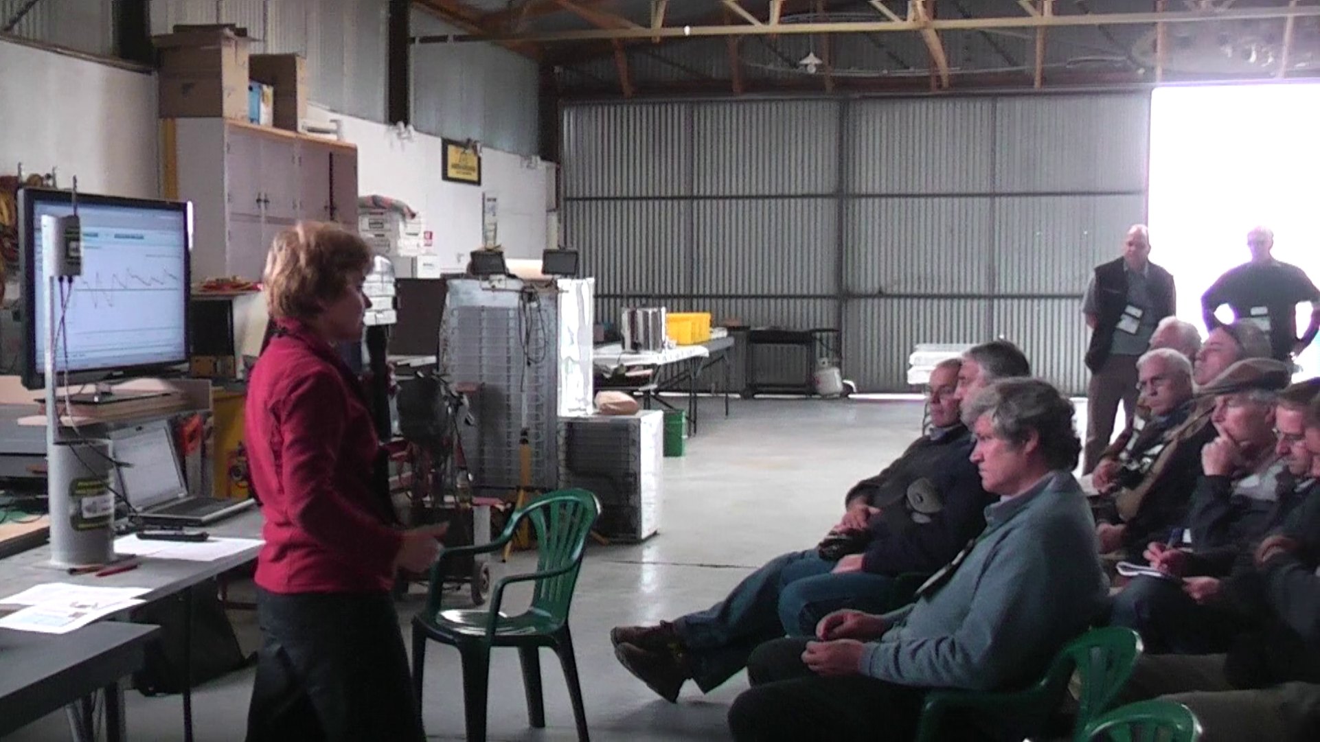
Mastermind of the " Maximizing the Value of Irrigation " program Dr. Carolyn Hedley explaining the advantages of farmers using soil moisture networks for precision irrigation scheduling to maximize irrigation efficiency.
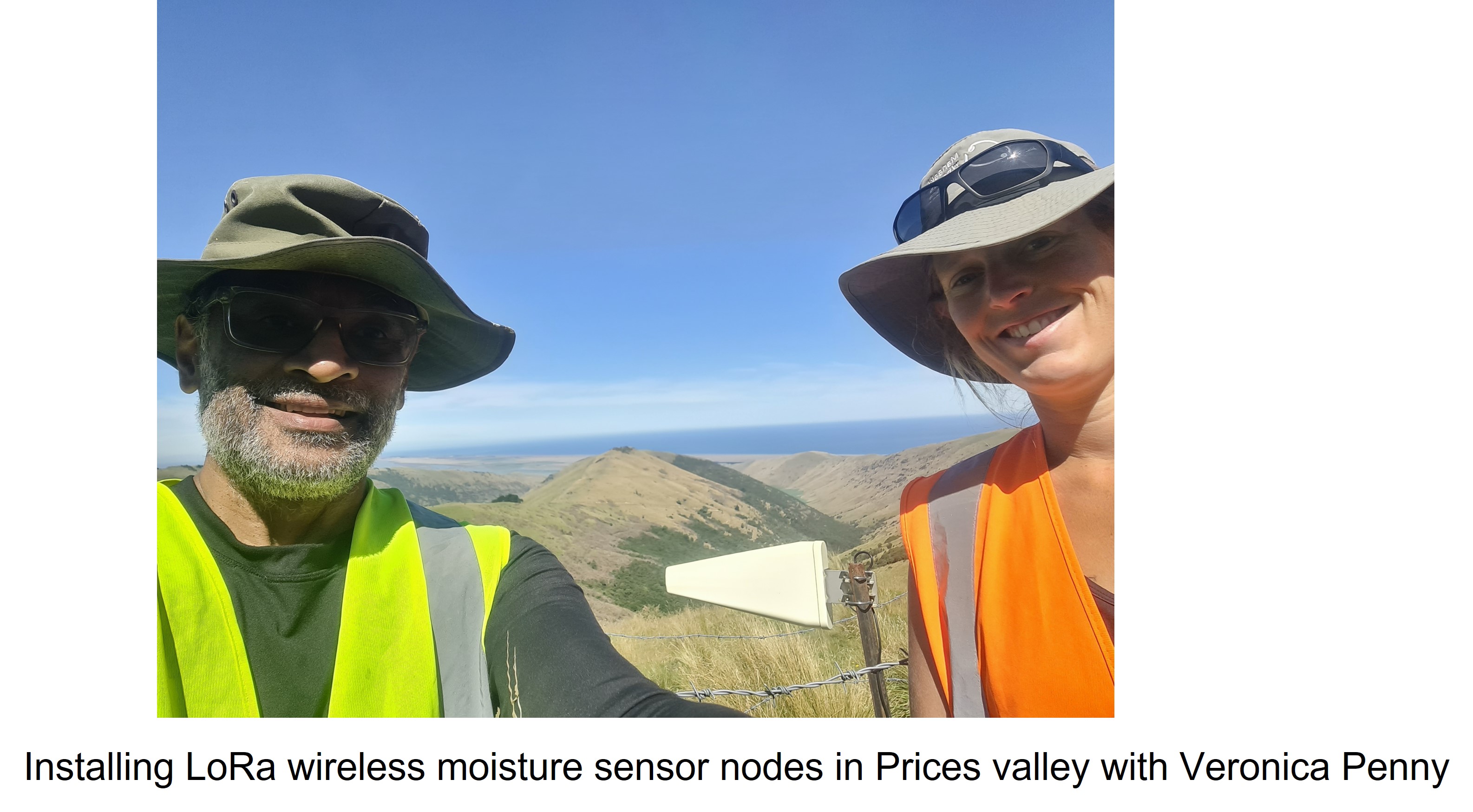
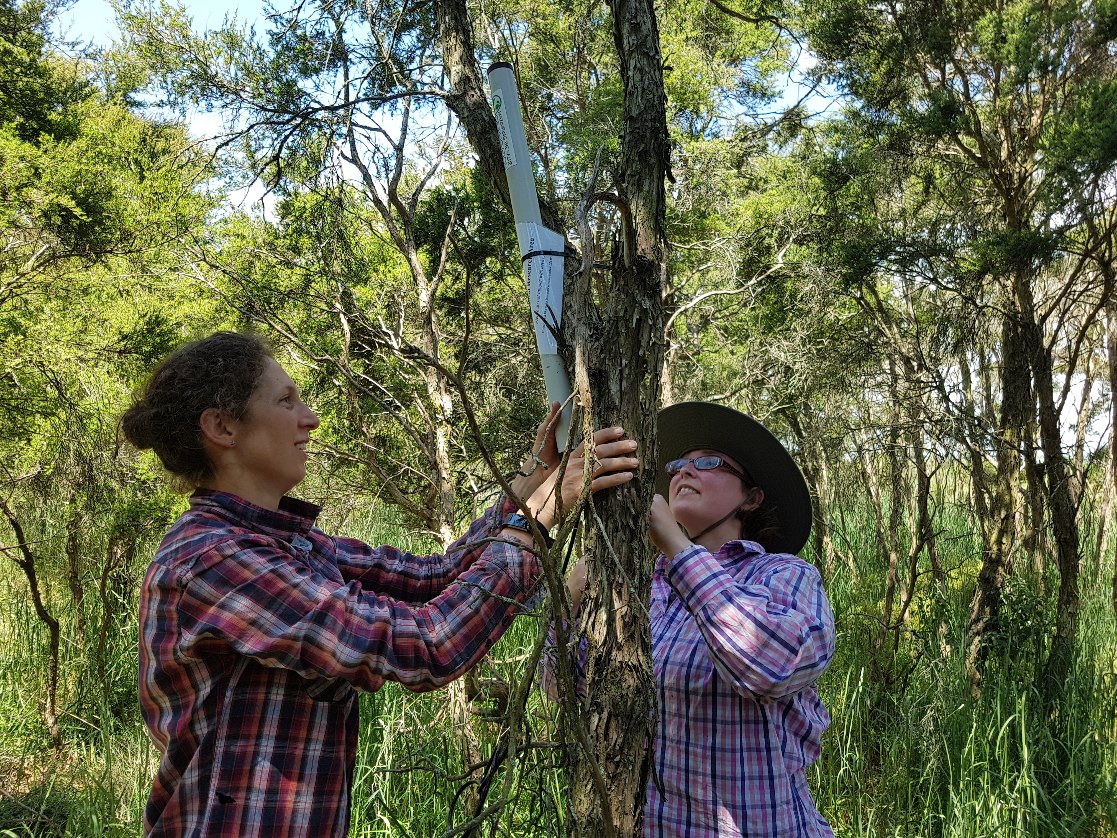
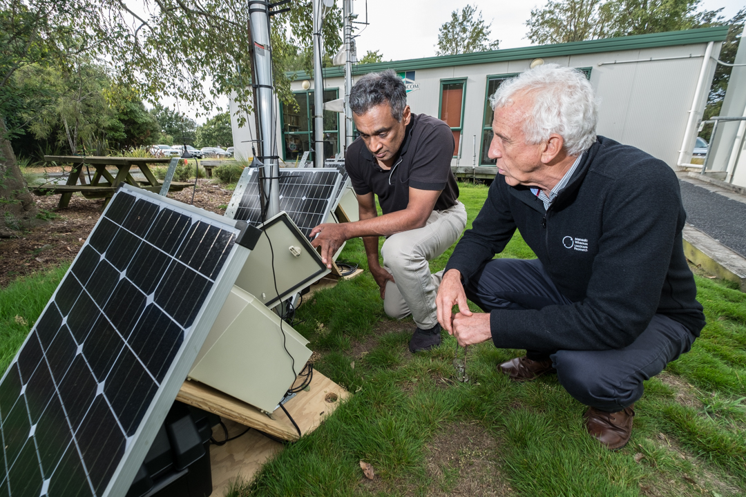
Use of LoRa radio technology:
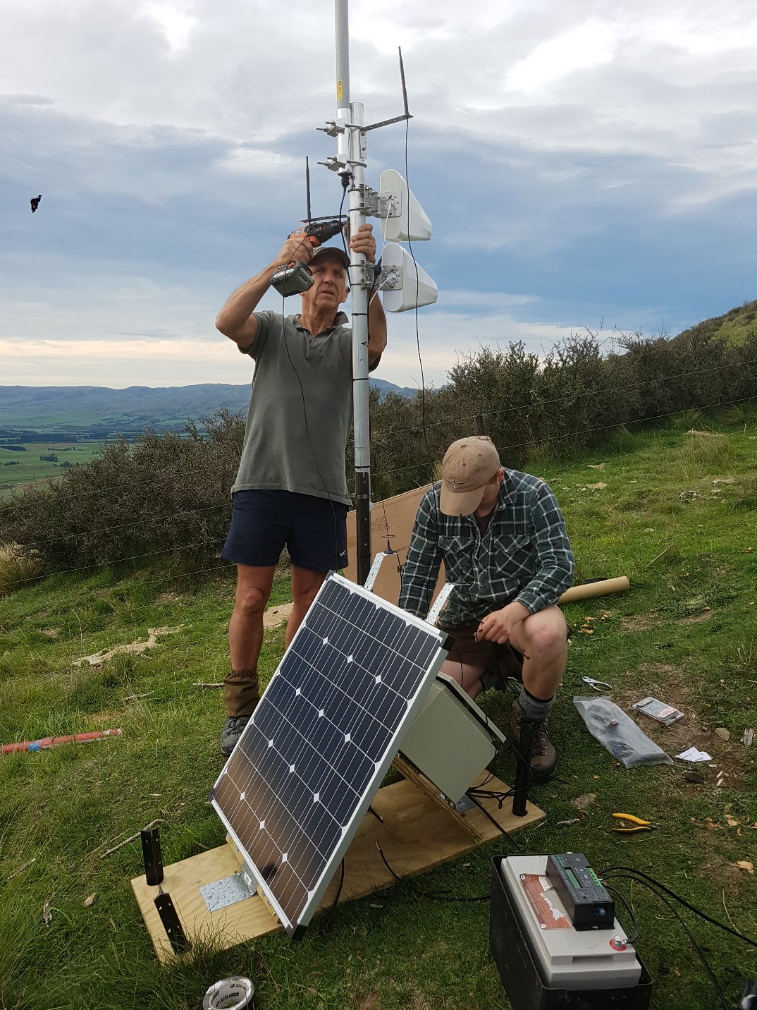
Latest low power LoRa radio technology enabled us to expand our measuring area over 100 sq.km. These LoRa sensor networks guarantee 10-year battery life (13000 mAh) for hourly data measurements. Range tests showed that they could communicate distance over 60km (L.O.S). Veronica Penny is installing a wireless LoRa sensor node in Inverary catchment under the direct supervision of Fly.
Advances in Information Provision from Wireless Sensor Networks for Irrigated Crops (scirp.org)
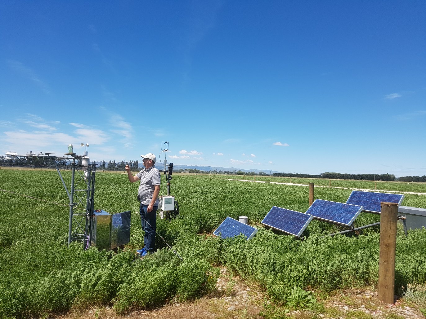
Moisture monitoring in large catchments:
Moisture monitoring for MBIE Endeavour-funded project called “Hill Country Futures” run by Beef + Lamb New Zealand Ltd.
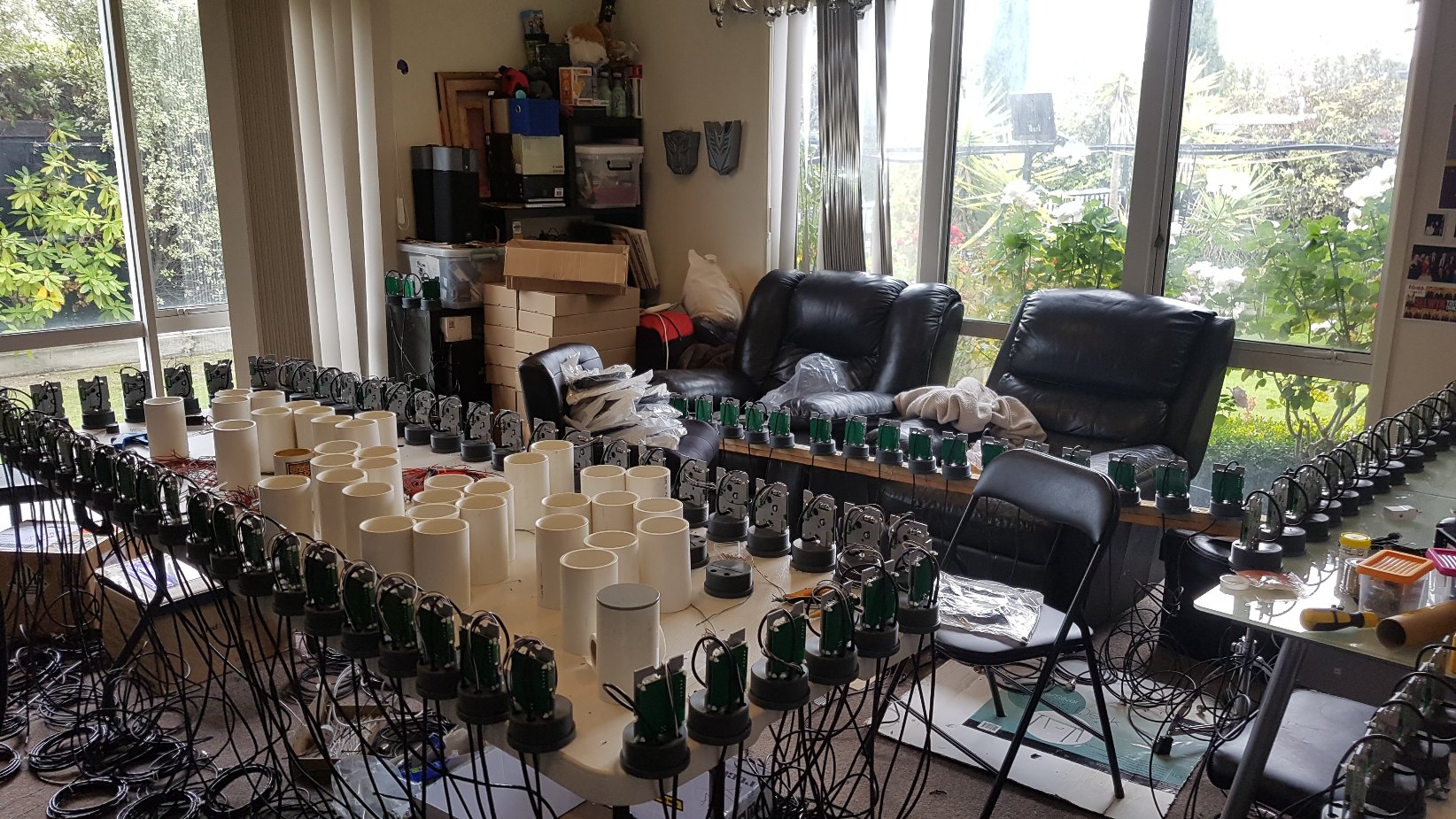
120 wireless LoRa sensor nodes were constructed during the lock down period to install in 6 catchments around New Zealand. Catchments area varies from 10 - 30 sq.km. Because it was completed during the lockdown period this story went viral Five Scientific Achievements That Happened During Coronavirus Lockdown | Innovation| Smithsonian Magazin
Soil sensors in the living room – how science keeps going during lockdown | Beef + Lamb New Zealand (beeflambnz.com)
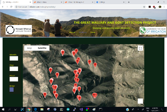
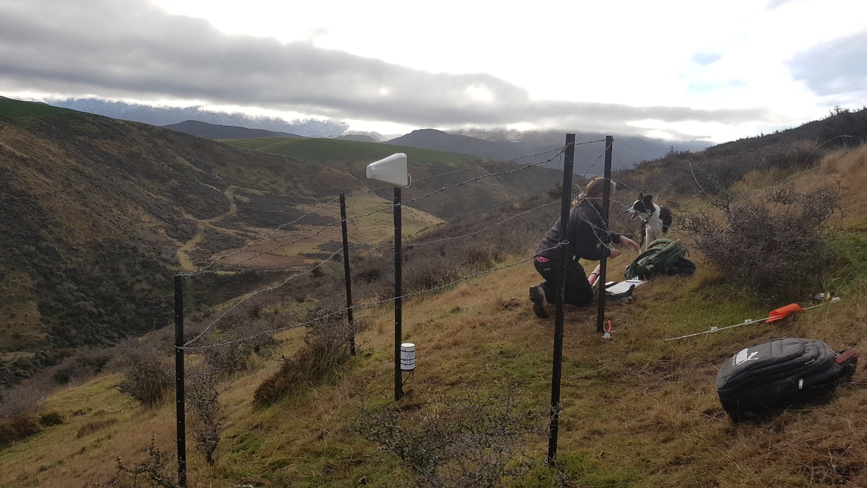
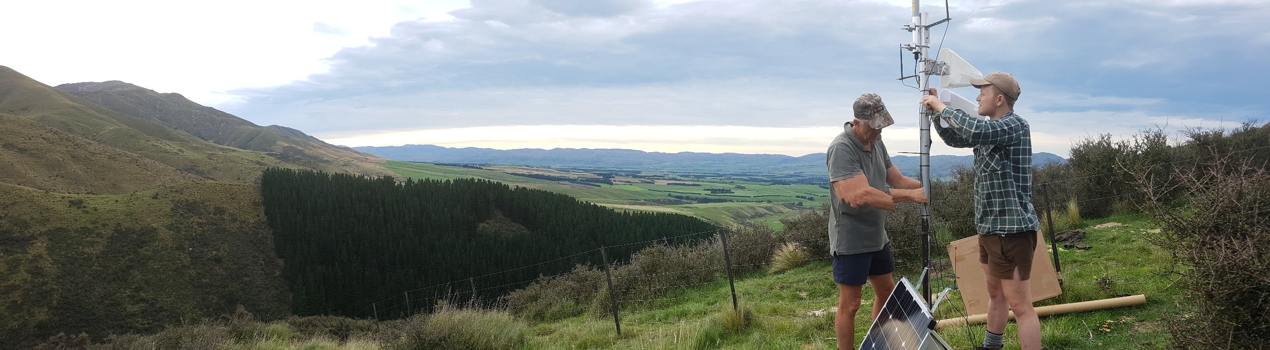
Monitoring movements of Wallabies in Waimate with no cellular coverage:
Digimesh self-healing, self-organizing and sleeping wireless network was used to study movements of Wallabies in near real time in Waimate. Wallabies were fitted with GPS modules and Digimesh radios. Digimesh protocols were used to form self-healing, self-organizing, sleeping and moving wireless radio networks. Because there was no cellular coverage in the research area, a Yagi antenna was used to link the local network to a cellular tower over 40km away. The gateway is installed at the highest point in the catchment to connect the network to the cellular tower.
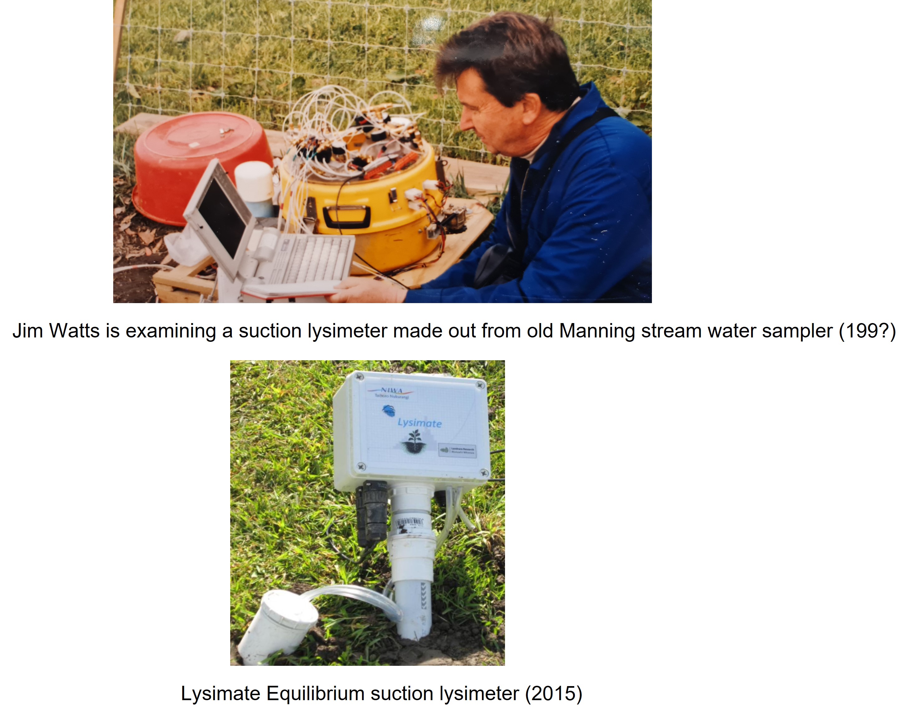
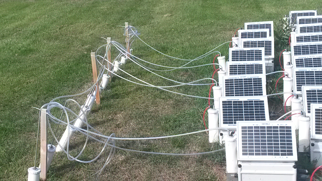
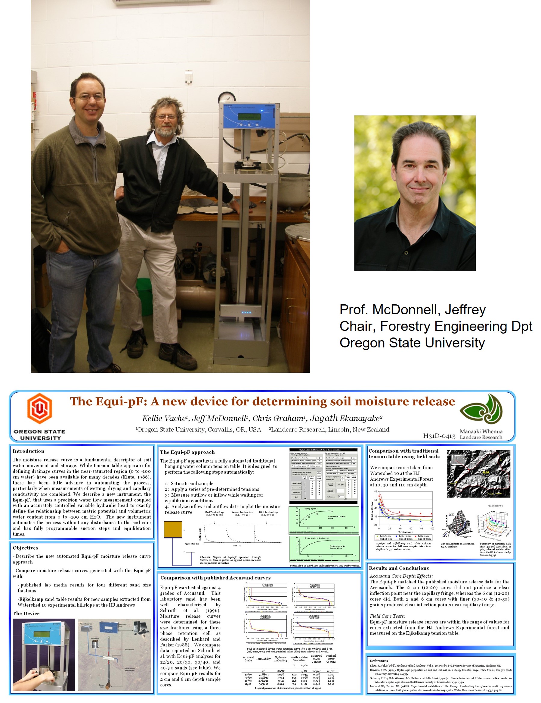
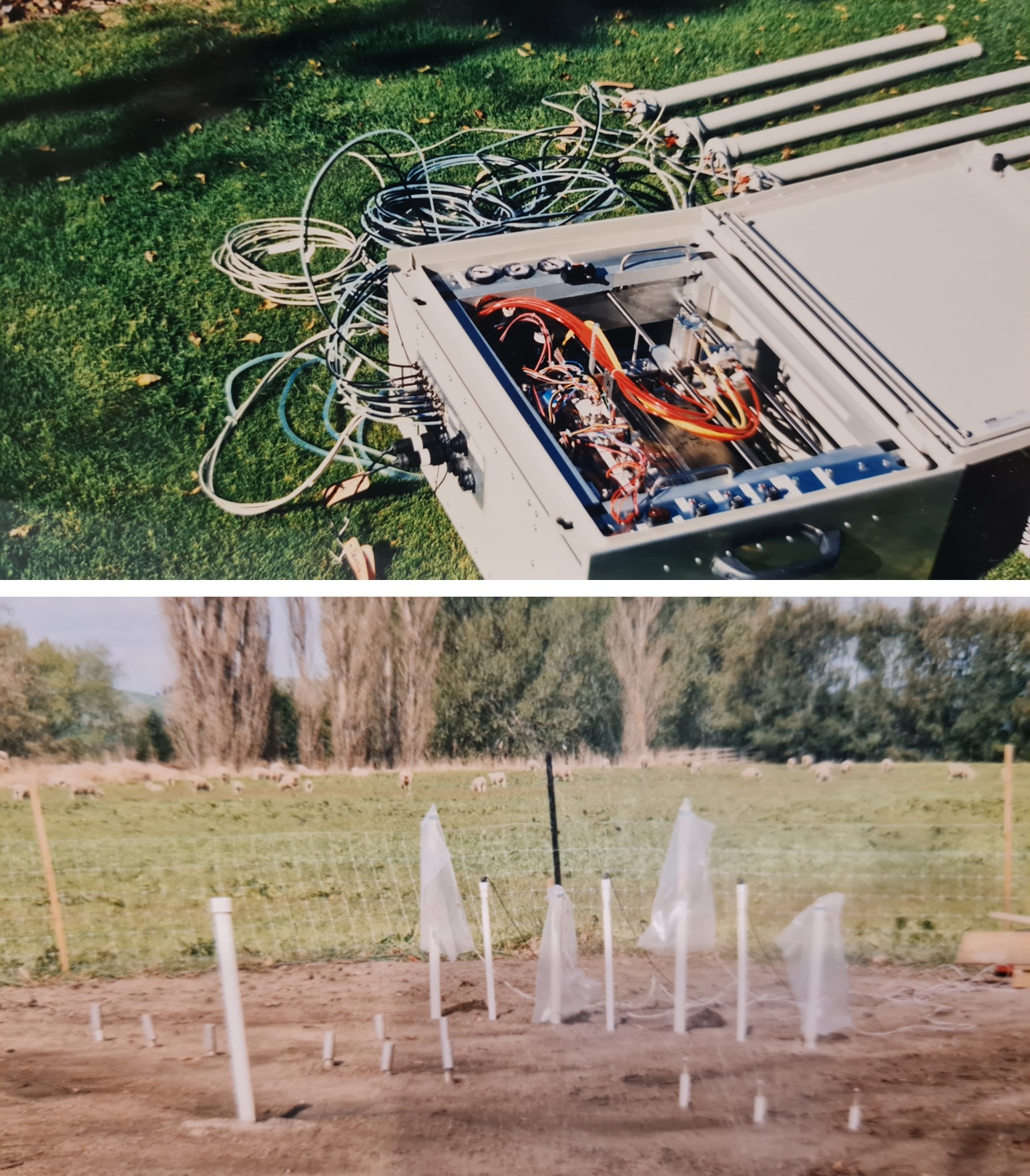
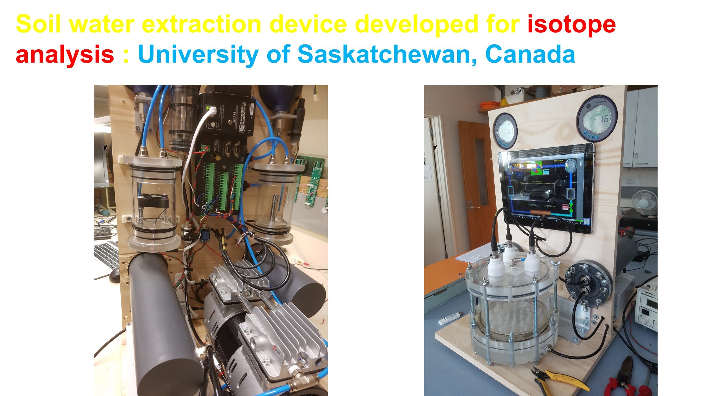
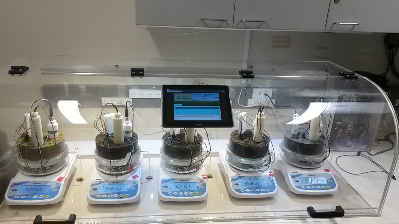
Measuring water retention properties of soil:
Water retention properties of soil are essential to estimate hydraulic properties of soil which help to configure efficient irrigation scheduling. Manual methods of measuring water retention properties of soil are destructive and labour intensive. EQ-PF was designed to obtain water retention properties for both drying and wetting cycles automatically without touching the sample after setting it up. It was demonstrated at AGU conference in USA, and they used to call it "Touchless water retention curve apparatus"
Testing Swarm cellular network for remote data logging:
Landcare Research (MWLR) is custodian of Te Kohinga Harakeke o Aotearoa, comprising three Phormium (flax) collections: the Māori Weaving Collection, the Provenance Collection, and the Plant Variety Rights Reference Collection. They are managed by Katarina Tawiri (shown above). These important collections require irrigation during the dry Canterbury summer months, when their transpiration is higher, and so the opportunity to have a near-real-time soil moisture monitoring system for the three Phormium collections is of great significance.
Multi sampler which could sample water drain under gravity from eight locations and 72 samples was designed for University of Oregon State University USA.
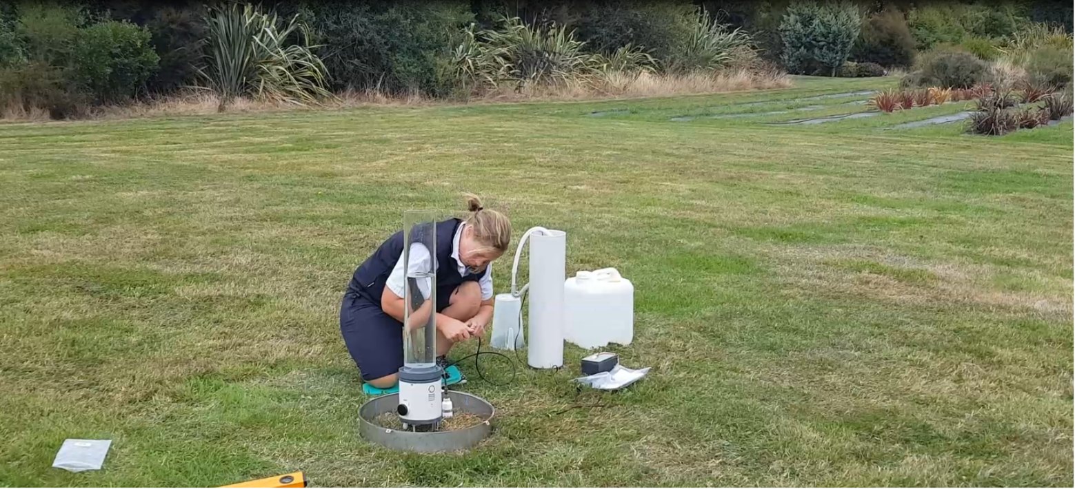
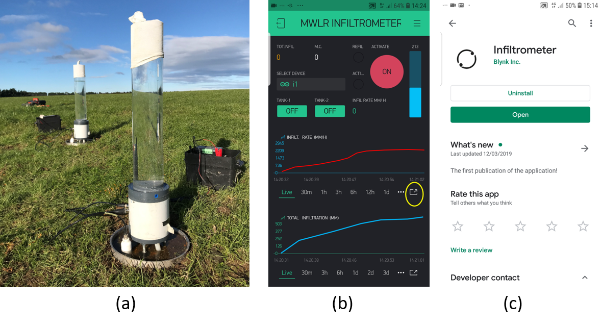
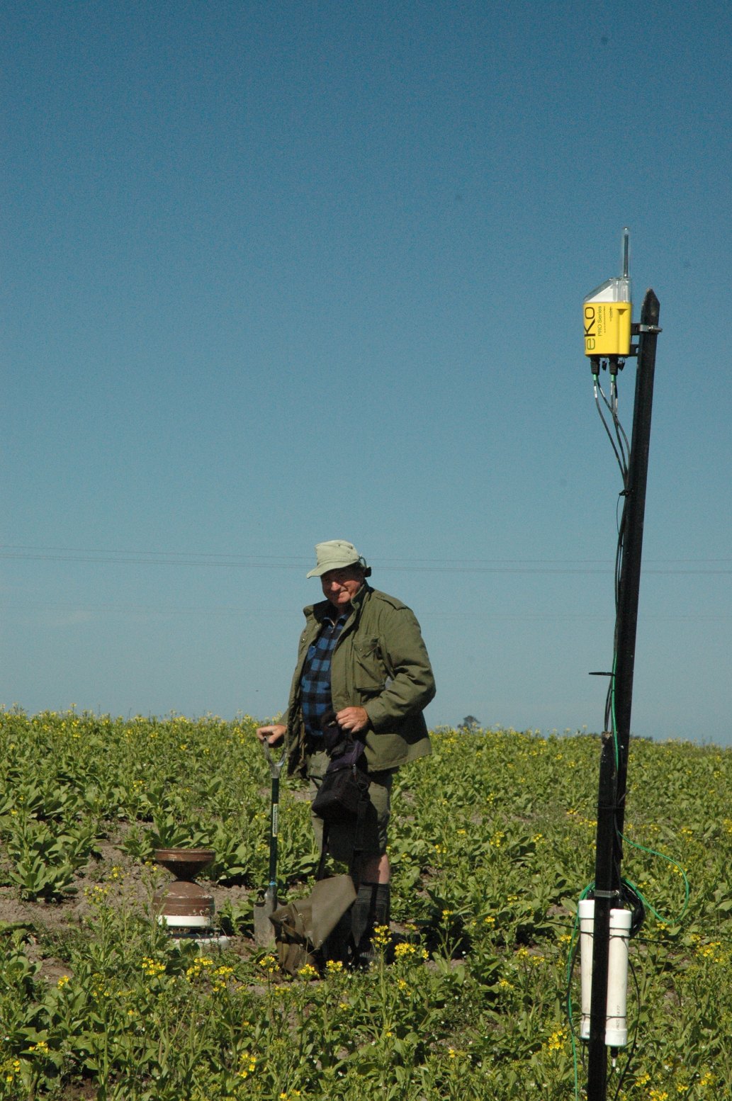
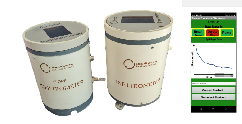
Install many infiltrometers in a catchment at different soil type locations and monitor and control all of them from one location by cell phone or web dashboard over the internet. Veronica Penny is demonstrating functionalities of the infiltrometer. Kirstin Deuss used 3 infiltrometers in Southland. Water reservoir automatically refills when it is closer to empty. Smart phone app allows one to monitor and upload data to the cloud. (below)
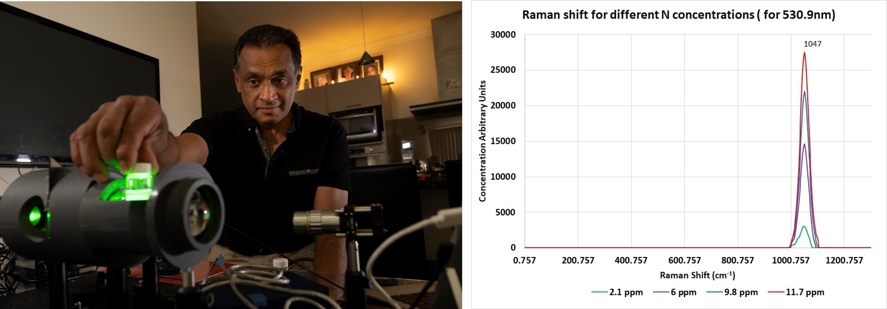
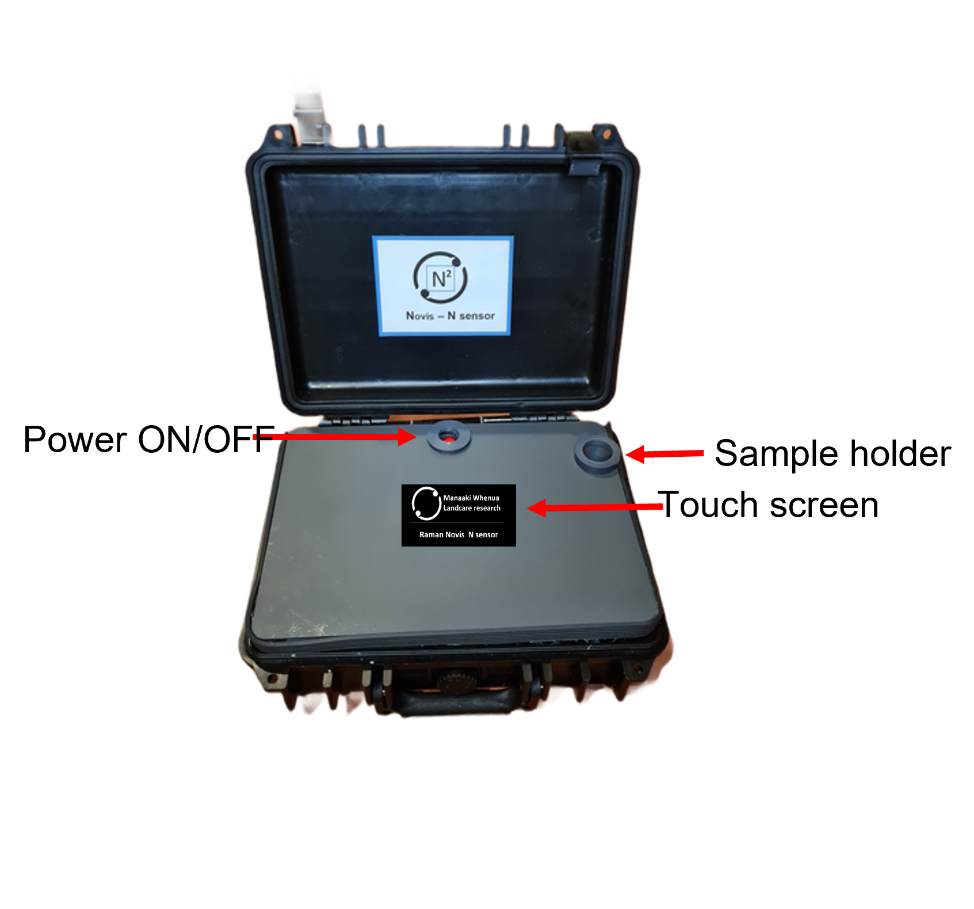
Completed lab-based Raman spectrometer Novis N sensor < $2000
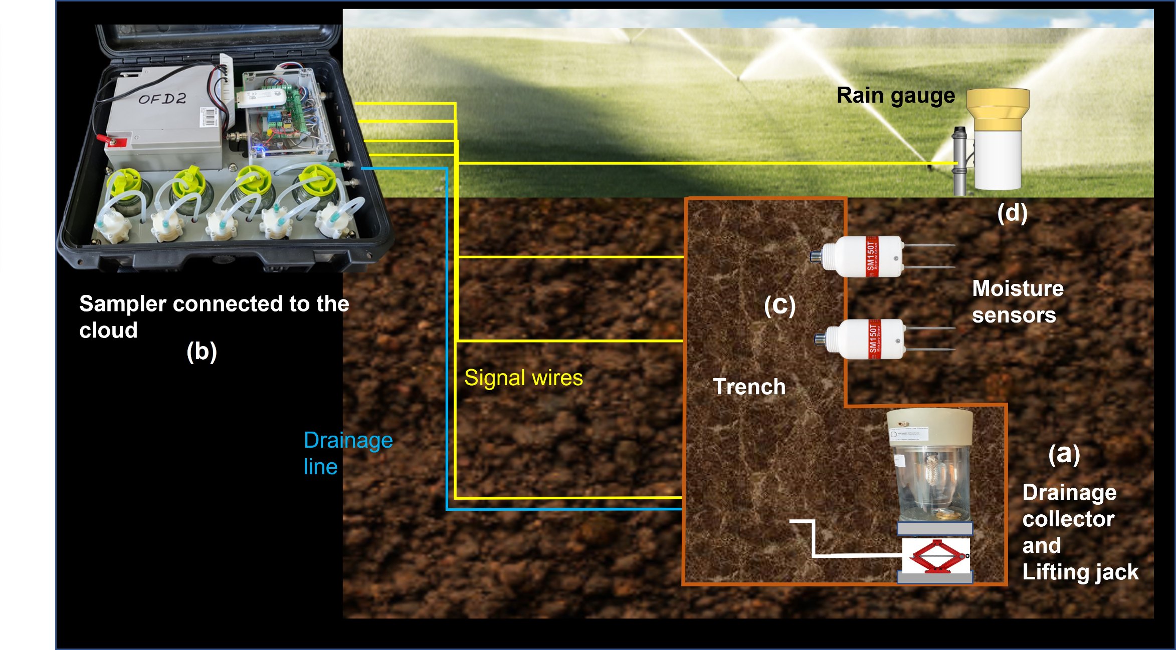
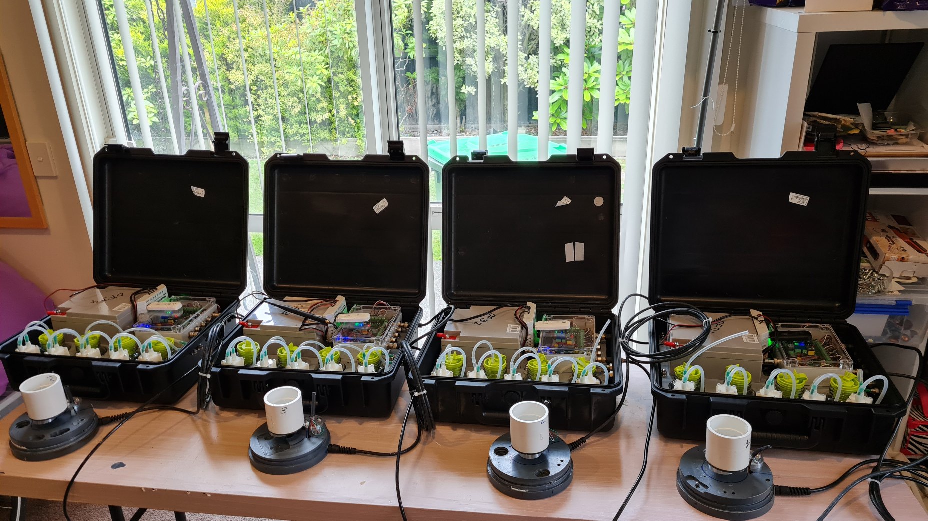
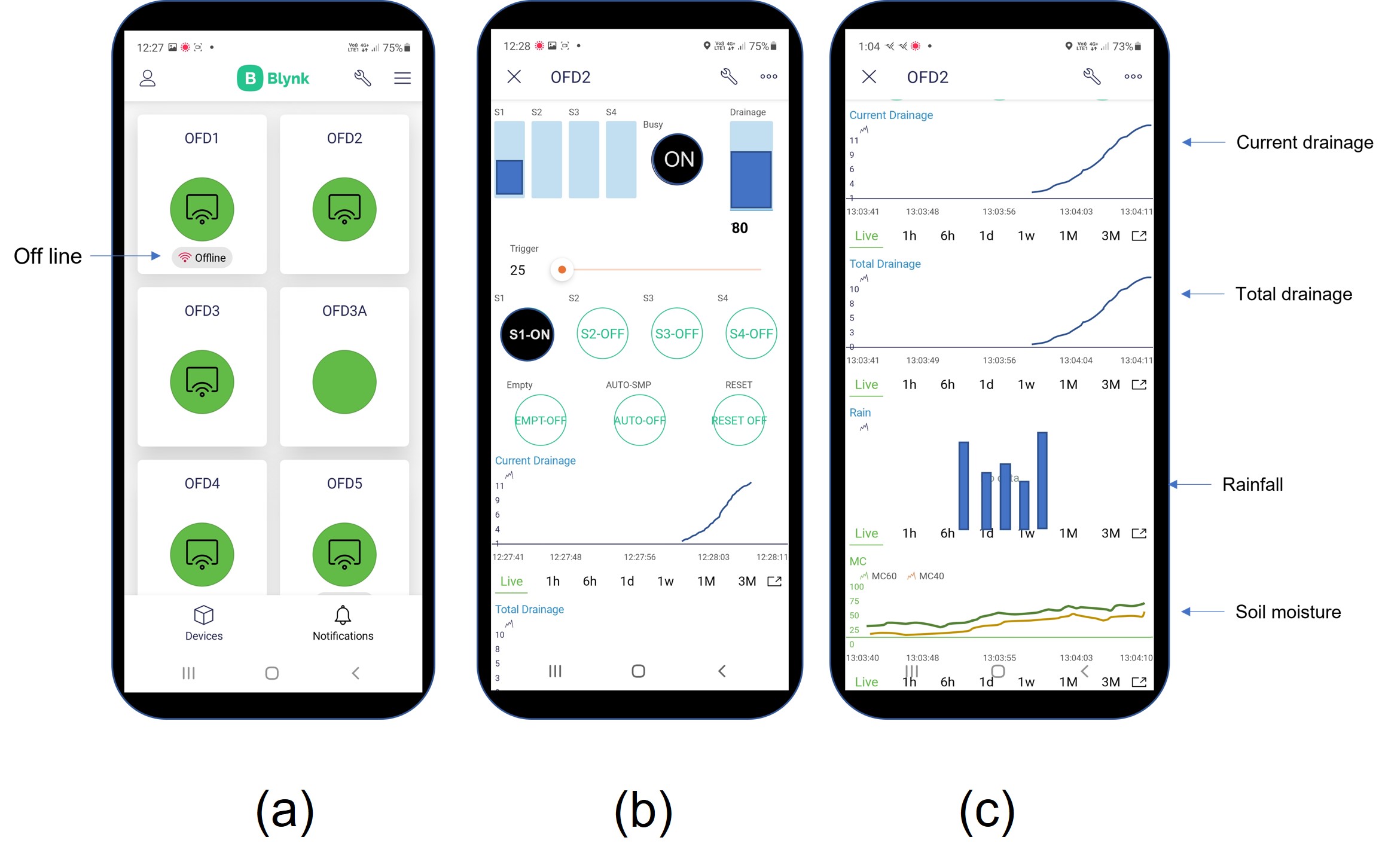
MWLR Science Den funded - Cloud connected smartphone driven drainage fluxmeter network. (commercialized)
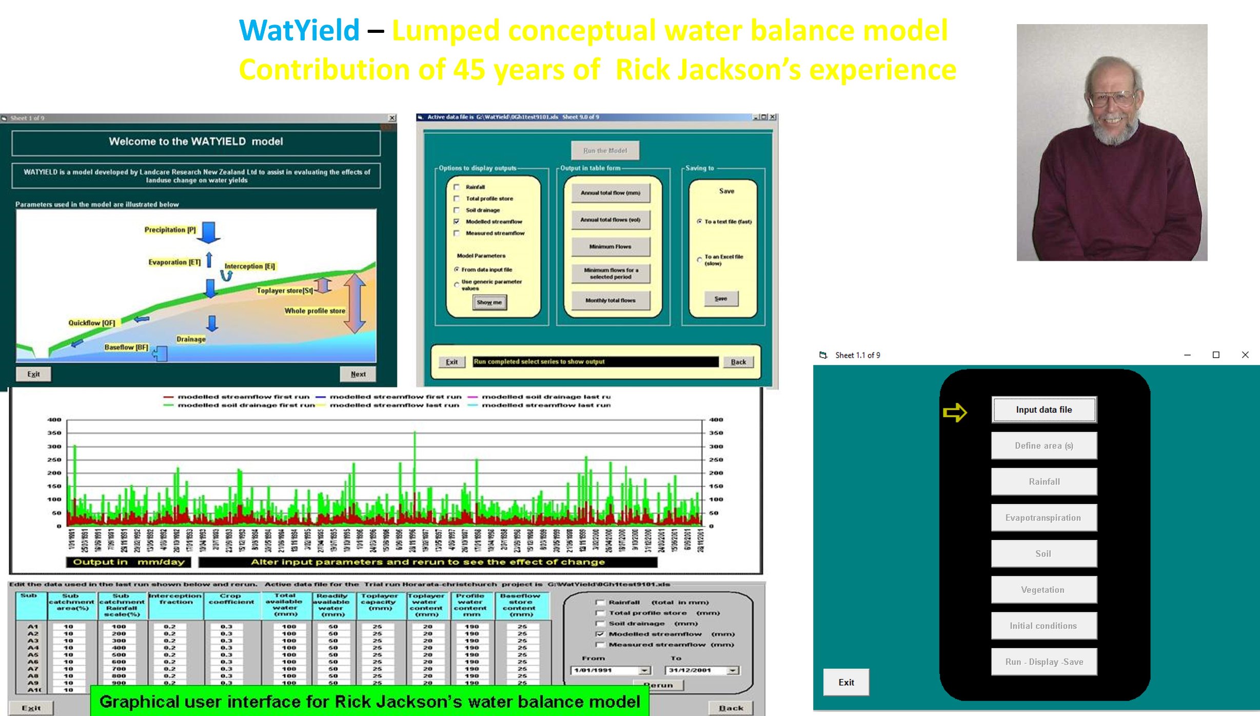
It was great honour to be able to design the graphical user interface for very popular Dr. Rick Jackson's Watyield water balance model.
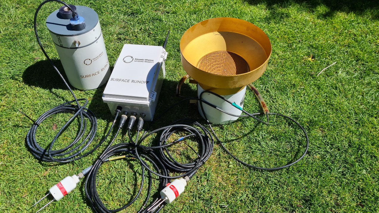
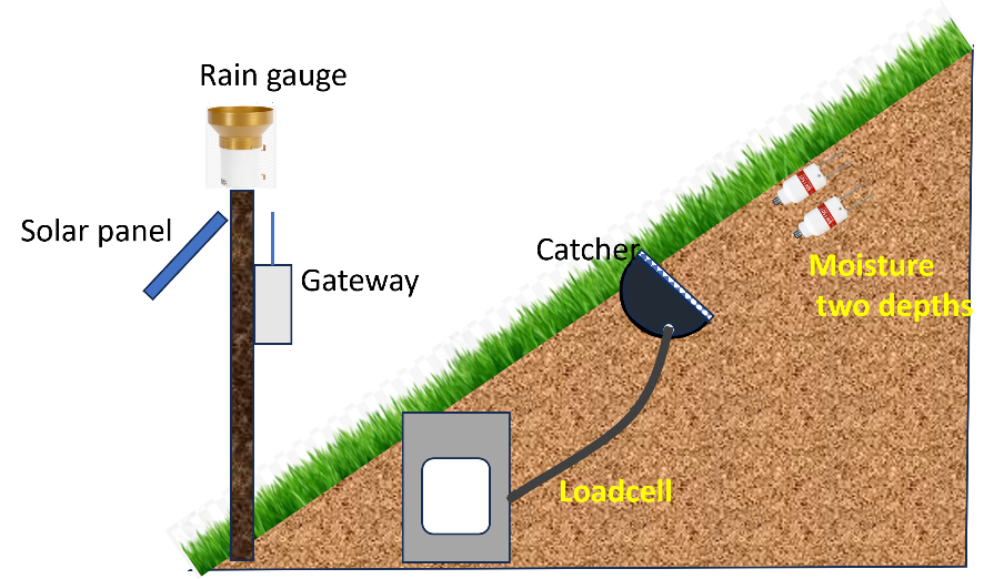
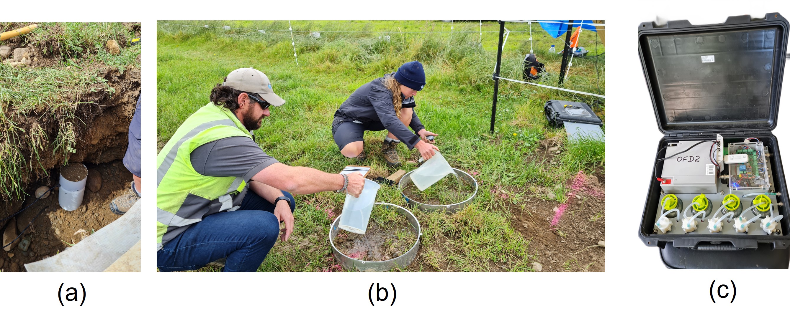
Surface runoff measuring system for hill country farms (2023 - 2024).
Jagath the Sant Claus
Thank you all for your contributions to make them happen: Jagath Ekanayake


